If you want to do every park in Fullerton; do this one last. It is incredible. It is well manicured; not merely maintained. It has picnic tables, a BBQ, three walking bridges, babbling brook, (all year long) and absolutely stunning in the amount of green even in late autumn of a year with no rain. Most of this webpage will be on the park itself, so if you are here only to get directions to places to park hit the Page Down key six times.
 It has the tallest of trees around a very deep valley. There are eight places to park next to it, and yet no parked cars can be seen from within the park. And if that isn’t design perfection enough, it is on two levels. This park is in a neighborhood that is away from the main streets of Fullerton and thus very much under utilized. Trails described in this webpage take a lot of explaining because they are so unused, the normal wearing in of trails is absent. You have to go on faith in many places.
It is in the extreme north-east corner of Fullerton near the 57 and Rolling Hills Drive. Rolling Hills Drive is an amazing street. It has to be the least used four lane street in the world. It isn’t even a mile long and goes nowhere. (Well . . . it ends at Tri-City Park.) Street planners sort of goofed here.
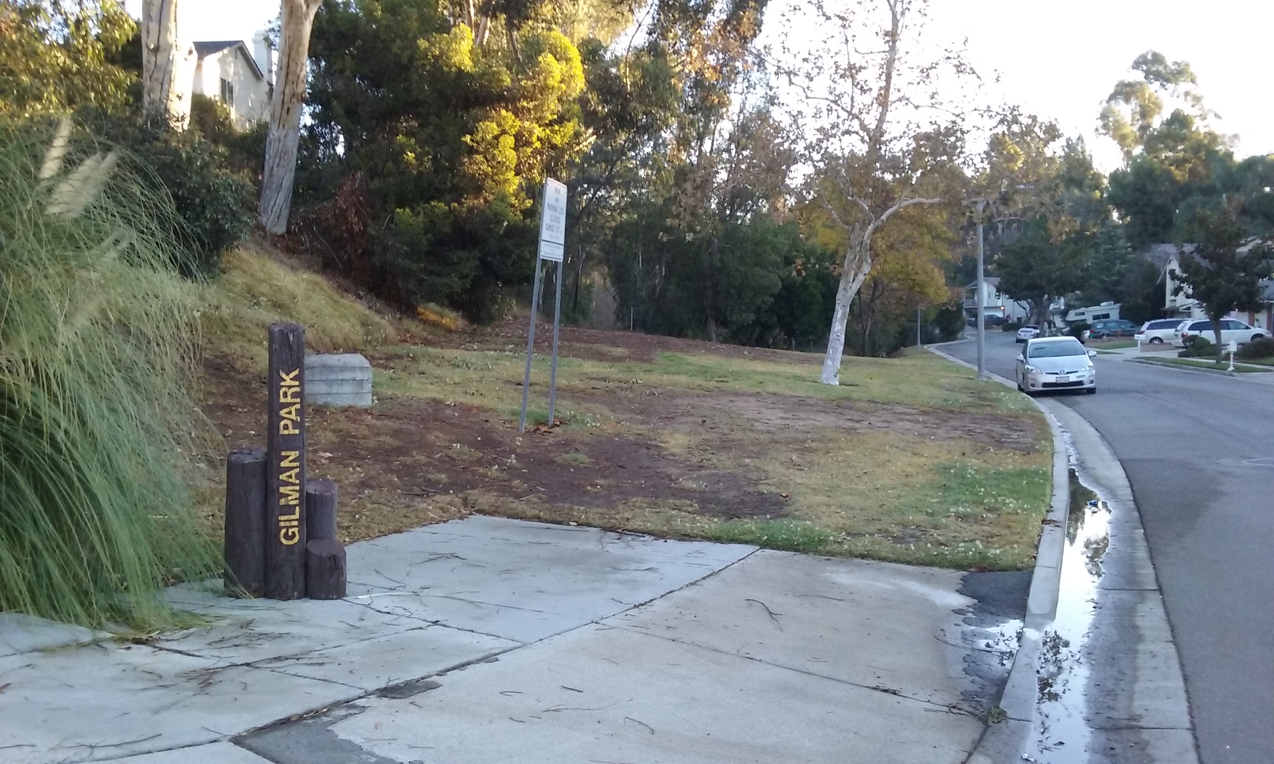
___G Gilman Park is on the south side of Rolling Hills Drive; 1/2 mile east of Associated Rd. Down hill from there actually. You enter the park at its highest point there. The Google Earth view in the gallery below can be made interactive if you have Google Earth loaded on your computer. Enter this lat/long into Google and then click on “map”: 33°54’07.9″N 117°52’36.4″W. Click here–> for instructions on using Google Earth.
 Gilman and Orange County History The park is named after Richard Gilman, who founded the first commercial Valencia orange grove in California. The western end of the park was originally part of the Gilman family 1906 home site. A plaque of Richard Gilman’s accomplishments can be found on the campus of Cal. State University in Fullerton. The reason it is there is because that original Valencia Grove was on the property that is now Cal State Fullerton. The particular variety of orange, the Valencia, ripens at a different time of the year than what Florida produced. Orange County should be named Valencia County. The history of Richard Gilman, his family, as well as the park, is available at the Launer Room of the Fullerton Public Library. (Gilman and Hillcrest are the most well documented of all the parks.) For more on the history of the Valencia in Orange County click here –> Phil Brigandi’s article on Valencia in Orange County

Seven Ways In The park and the housing development around it is about 40 years old. The housing tract was clearly built around access to the park for the neighborhood. But the architects of the park figured out a way to keep all seven ways in invisible from inside the park. The ways in for the neighbors to walk into are listed here just for the sake of completion. (Skip to the green text for access, if you drive here.)
- Treeview Pl south (via Medford, and Rolling Hills)
- Treeview Pl north (via Hartford, and Rolling Hills)
- Marymount (via Cambridge, Clairmont, Placentia)
- Hartford Ave (via Cambridge, Bastanchury)
- Hartford (via Treeview, Hartford, Rolling Hills)
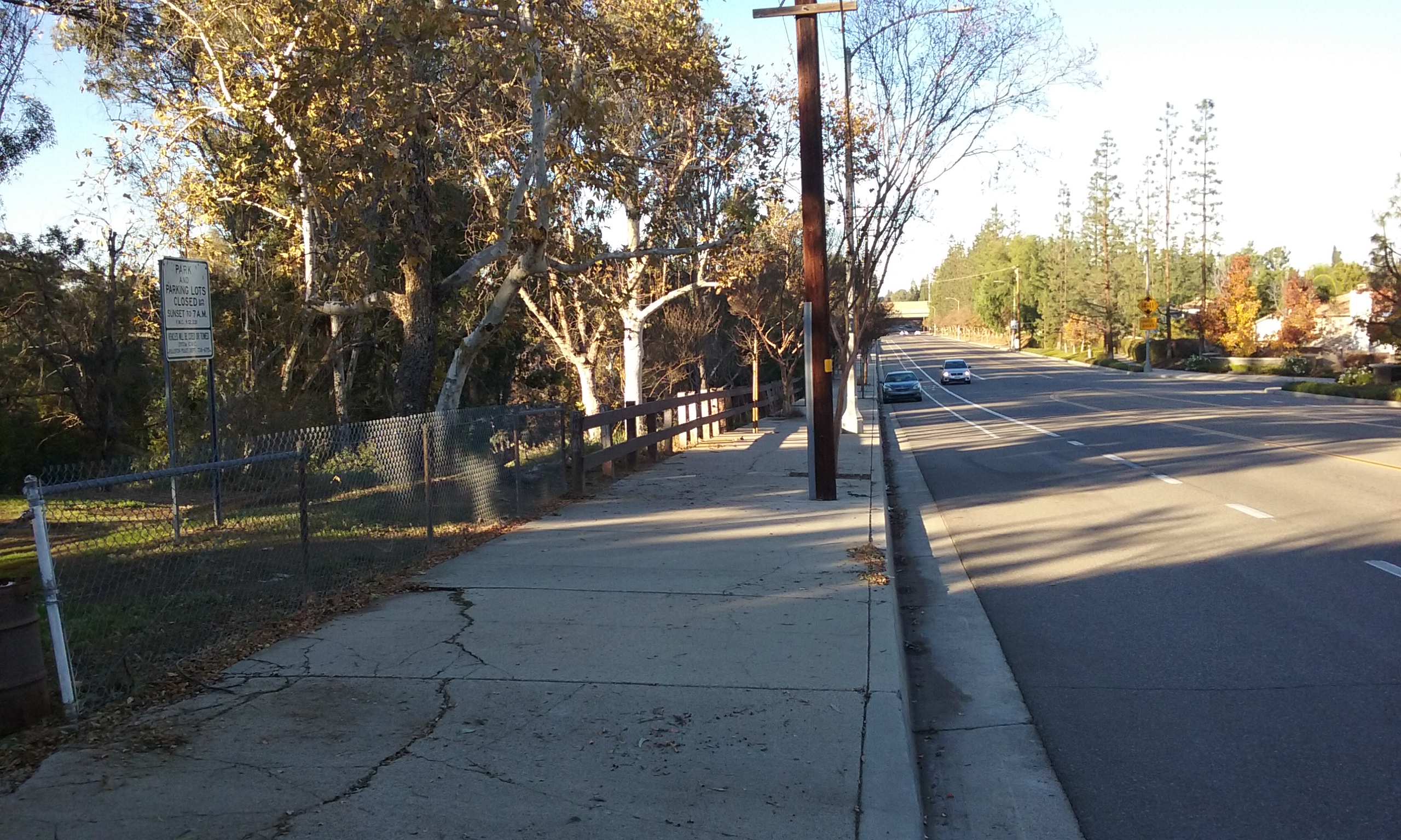
- The best place to park for those that will be driving here is the south side of Rolling Hills Drive. You can get to Rolling Hills Drive from Associated Road (a few blocks north of Bastanchury). Watch your odometer for 1/2 mile to go by then park along the street. Look for a chain that marks the service entrance for park maintenance.
- The second best is the Eucalyptus way in. (Parking along any street in the list above is OK.) From Bastanchury, just east of the the 57 Fwy, turn left on Hartford, left on Devonshire, right on Deerpark, 3 blocks to Eucalyptus.
 The Gilman Loop (1 mi)
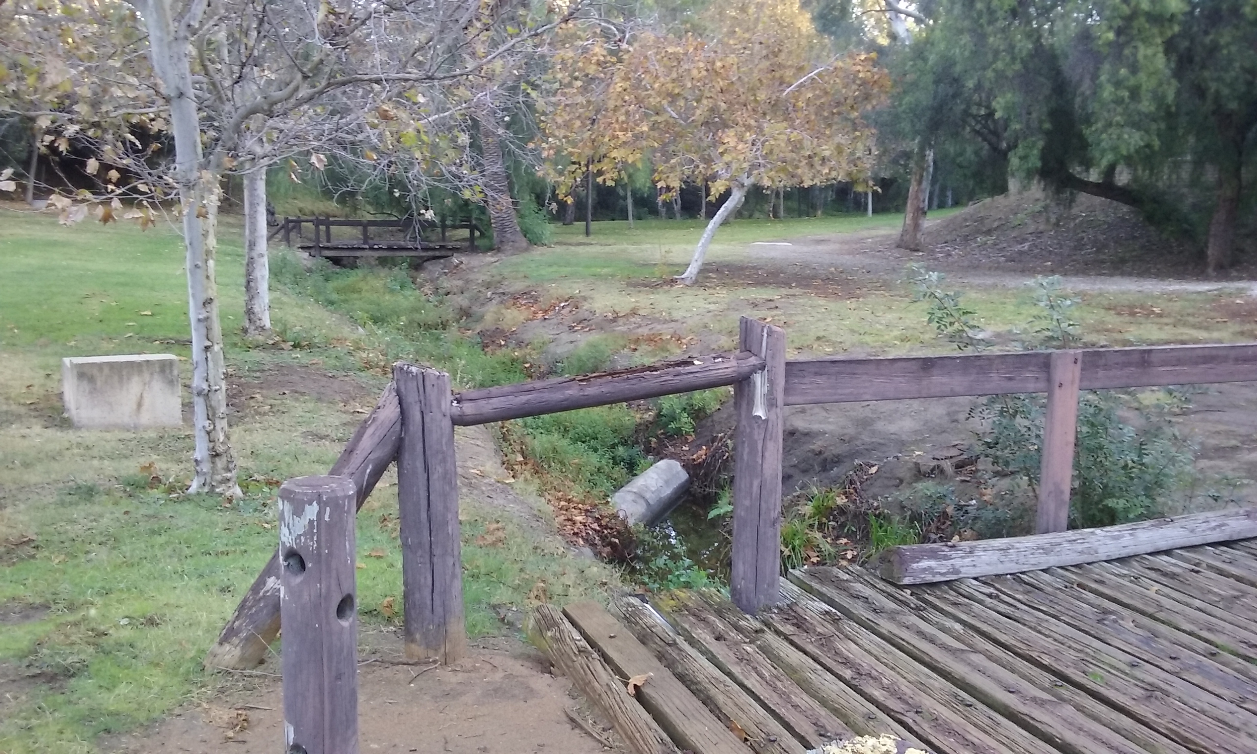
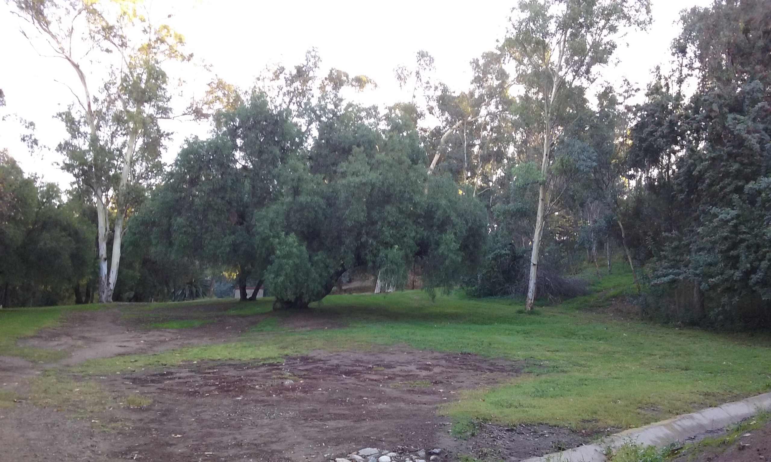
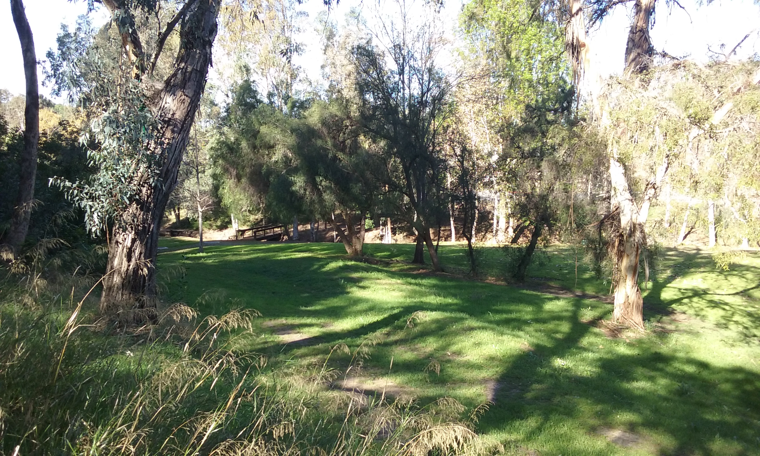
The trail, starting at the Eucalyptus way in described above, is wide at first where it was deliberately graded. But it is so unused there’s no warn path to confirm you are on a trail. (This lack of wear is evident throughout because the park is so unused.) Before you go too far up on the north side of the creek appreciate the beauty of the creek here. It is the only park where water is running all year long. Note also how deep the valley is that you are in and how tall the trees are that are planted on the sides. This is the best walking loop in Fullerton on a hot day. Just about everywhere is in shade. The trail climbs to the very highest point which is the Rolling Hills Drive entrance. This is also a good place to enter 1 mile loop. The trail continues south, but once again, it is so rarely used, you can never be sure it is a trail. You will walk along side a concrete U-channel next to a fence that marks the backyards of eight houses. (Trees prevent the park users from seeing these houses.) There’s just enough room on the park side of the U-channel to walk safely. You are assured you were on the trail when you encounter a park bench near the Treeview Place entrance. The picture in the gallery below with the name, “south end of trail…“ shows that bench at the end of that narrow path where it joins the sidewalk from Treeview Place. The trail continues west but the better trail is slightly downhill from there. Once again go by the slope of the hillside as a guide because there’s no hint of a warn path. Pretend you are forging the trail, and just go down the least steep way. Eventually you will be in the widest part of the park with acres of grass.

Two Parks
Gilman Park is mostly in a valley which has been flattened at the bottom with bulldozers to make a wide, irregularly shaped lawn. But the park boundaries includes an acre or so at an upper level. The top picture of this webpage is of this upper one acre park. This is accessible from Marymount or Hartford (see the list of entrances above). From the map, even the 3D view with Google Earth it’s hard to notice the height change which the developers turned into two parks. This upper park has one rather steep trail down to the rest of the park on the west end. Like most of the trails it isn’t used enough to be readily seen. Look for a slope on the north west side that looks like it should have a trail. All the way down there’s a wonderful view of the lower park. There’s also a lovely walking trail from the east end of the upper park. The trail goes down to a rather new looking concrete block building sits. This building used to be a restroom and is now storage. (See below for what this park was like before it was made safe for the City Council.)
 Bird Watching
While wandering in this park you may meet a wonderful lady with a deep French accent. Here name is Christi. She’s a birder; a volunteer for Cornell Lab of Ornithology. The reason this park is good for that, she will inform you, is because it is a quiet park; you rarely see anyone in this park anymore. Essential for birds also; there is water in the creek all year long and most important there’s a number of trees that are dead but left standing. For more on the conservation effort to keep the parks departments in America from cutting down dead trees see Cavity Conservation Initiative.
 A Sad History About the Park
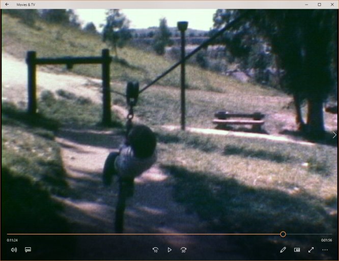
Gilman Park was sculpted out of a mere plot of dirt around 1979. Before that, very few trees but lots of bike paths and it had a hill that was so steep the bikers named the whole place “Suicide Park.” That inspired the park architects (yes architects; this is the only park to be designed by professionals; all the rest are just leftover land that was grassed) to put in a 110-foot concrete slide; two slides actually. One went through a tunnel. These were for kids sitting on cardboard. It was of course safe if used that way, but one or two bikers who remembered the place as “suicide park” used the slide as a bike path. There are bike paths “created by bikers” in other parks, that are also dangerous, but this slide was “created” by the city. That made the city vulnerable for lawsuits. So the City Council had it removed along with the other fun things when word got back to them of these two idiots. The two slides, were removed along with the zip line, short track line, the tree house, a bicycle motocross trail and traditional play equipment. During the hearings for the action to remove this equipment, 20 neighbors took 3 hours to speak in opposition to removing them. This park was one of the most well attended parks in the city. Apparently it took 13 years for the Council to learn that it was too much fun. Now it has become the least attended park. 
These videos are from a SuperEight film a neighbor took around 1980. Notice how few trees there were then.
- short video of the slide –> swale slide
- video of the zip line for kids –> zip line
- video of slide through tunnel –> both slides slide backwards
- for a short video of the tree house –> tree house

Extending the 1 Mile Loop
You can extend the 1.1 mile loop described above by exiting the park when you get to the very top next to the Rolling Hills Entrance. Cross Rolling Hills Drive. Walk east on the sidewalk and then go left (north) on Placentia Ave all the way to Arts Ave. (Placentia Ave here is hilly and curvy.) That’s as good a place as any to turn around in that it is the city limits. That out and back sidewalk journey adds a mile to the 1 mile loop described above.
Click on a picture to see it in full screen.


Suggestions for Parks and Recreation
None. This park is perfect.
Well, you could make the Rolling Hills Drive entrance a little more welcoming. (There’s plenty of parking up there.) Maybe a new sign and a way in so you don’t have to climb over the chain.